

On this day we learned about Columbus’ 3 ships the Nina, Pinta, and Santa Maria. We learned what life was like for the sailors on the ships and actually measure out how big the ships were. J also learned about navigation in Columbus’ time and got to explore outside with a compass.
1. Review: read “At Home in Portugal” on page 9 and “Off to Spain” on page 10 of Hands on History Christopher Columbus by Mary Tucker.
2. Read: pages 22-30 in Columbus by Ingri and Edgar Parin D’Aulaire.
3. Comprehension questions:
- Columbus left the port of Palos, Spain on August 3, 1492. He took three ships. Can you remember the names of the ships? (Nina, Pinta, and Santa Maria) Which ship was the smallest? (the Nina) Which ship was the largest? (the Santa Maria) Which ship was the fastest? (the Pinta)
- What did Columbus and his sailors hope to find? Gold and riches
- Who did Christopher’s son stay with? The monks
- What ship did Columbus ride on? The Santa Maria
- What direction did they sail? West
- Columbus’s sailors wanted to turn around and sail back to Spain, what did they threaten to do to Columbus? Throw him overboard
- Why did Columbus finally change the direction that they were traveling to the Southwest? To follow the flock of birds
4. Map Skills: How did Columbus navigate on the Ocean?
Columbus kept a logbook (journal) of where he thought they were. He kept track by checking his maps, following his compass, and watching the stars. He used dead reckoning to get where he wanted to go. Dead reckoning was a system of using a compass and the North Star to keep on course.
Define-Navigation is the art of getting from one place to another, safely and efficiently.
Maps- In Columbus’ time they had not yet developed a way to measure distances at sea, also they hadn’t come up with a way to portray the round earth on a flat map. This made the maps of the time very inaccurate. The size of each land mass on the maps were more of a reflection of their importance for trade routes than actual geographical size. The charts and maps had a compass rose indication bearing between trading ports.
Compass- Early mariners found the compass inconsistent; probably because they didn’t understand variation (a compass points to the magnetic north pole, not true north). They could not explain the variations and couldn’t put much trust in the compass readings when navigation unknown sea. Columbus’ compass was checked against the North Star or pole star.
Sun and stars- Navigators of the time could determine latitude (north/south direction) by observing the height of the sun during the day and the North Star at night. Ships could follow the east/west movement of the sun to determine the direction the wished to travel. However, the navigators had no way to accurately determine longitude. Once the ship was out of sight of land they had no idea how far east/west they were. They made estimates based on the time it took them to get there.
5. Discuss: read “They’re Off!” on page 14 of Hands on History Christopher Columbus by Mary Tucker. Have the students find the Canary Islands on a world map. Have them note how far Columbus had gone in 3 weeks and how much farther he had to go.
Compass Calculations
Go outside and explain how a compass works. Think and talk about how a compass could have helped Christopher Columbus. What direction was he going? Since a compass always points north, how did it keep Columbus headed in the right direction?
Give students various directions to follow such as: take 8 steps north, then 5 steps west, then 10 steps south and see where you end up?
Ask them which direction they need to go to get to the car? Or back to the house? Or to the trampoline? Students use the compass to figure out the directions they should go.
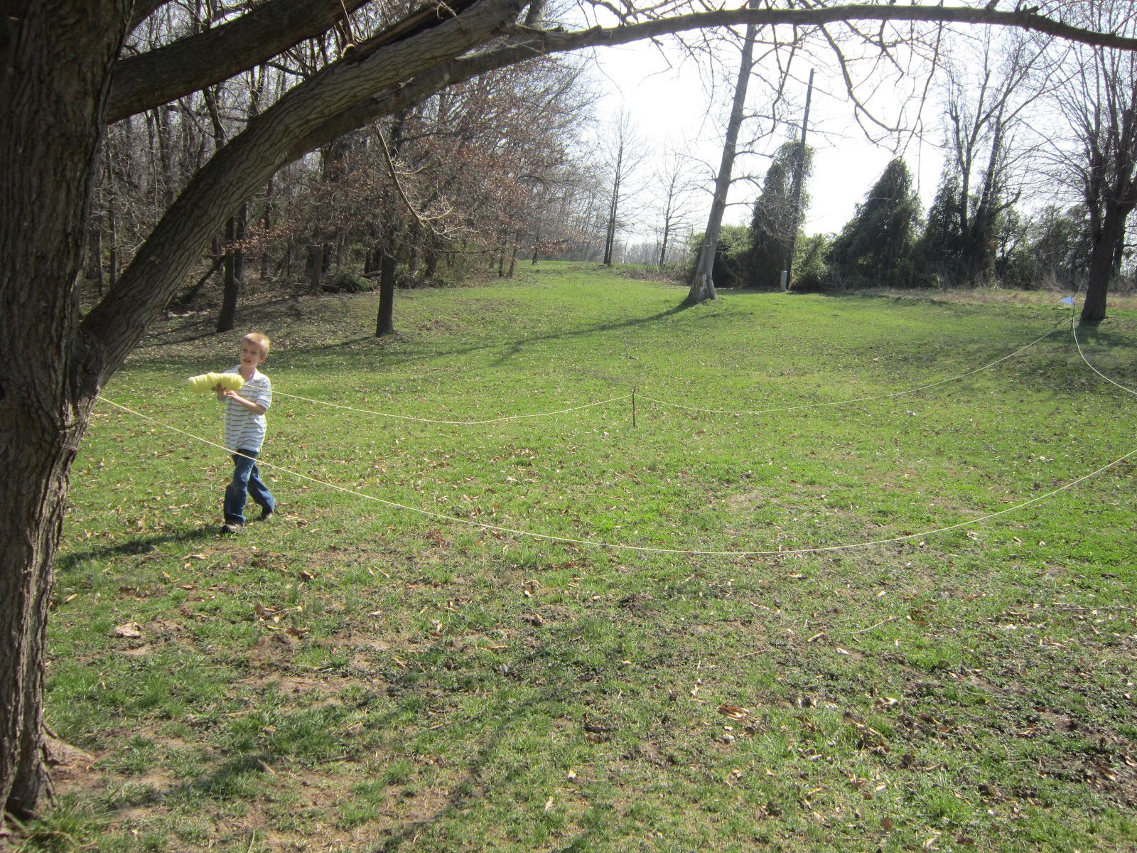
Measuring Columbus’ Ships

1. Discuss the size of the 3 ships:
Christopher Columbus’ fleet consisted of three vessels obtained in a tiny Spanish coastal port. The Pinta and Nina were caravels: boats that were longer for a given width to give them a streamlined configuration. The Pinta was three-masted with square-rigged sails; the Nina, though the smallest, had four masts and was lateen-rigged (triangular sails).
Santa Maria:
Class and type: Nao
Tons burthen: 108 tons (119 short tons)
Length: Est. at 17.7 m (58 ft) on deck, and about (22 m) 72 ft length over all.
Beam (width): 5.85 (19.2 ft)
Draught: 2.92 m (9.6 ft)
Complement: 40 men*
Pinta:
Class and type: Caravel
Tons burthen: 60 – 70 tons
Length: 17 m (56 ft) on deck
Beam (width): 5.36 m (17.6 ft)
Draught: 2.31 m (7.6 ft)
Complement: 26 men
Nina:
Class and type: Caravel
Tons burthen: 50 – 60 tons
Length: 15.24 m (50 ft) on deck
Beam (width): 4.85 m (15.9 ft)
Draught: 2.07 m (6.8 ft)
Complement: 24 men
Materials:
- 3 pieces of white construction paper
- Marker
- tape
- ball of yarn
- 9 long sticks (2ft-5ft)
- tape measure or yard stick (something to measure with)
Procedure:
- Cut each piece of white paper into a large triangle flag, write the name of each ship on one, and tape them to the top of the 3 largest sticks.
- Start at a tree and measure out the length of the largest ship first (Santa Maria length over all) and put the flag stick in the ground (you can soften the ground with a cup of water).
- Then go the the middle of that measurement and measure the width, putting a stick in the ground at each end of the width.
- Tie the yarn to the tree and run it along the outside of the 3 sticks in the ground to form a kind of outline of the ships deck.
- Repeat with the Pinta and then the Nina.
- If you have 24 in your class you can have them all stand in the Nina outline and ask them if they feel crowded? Would they like to eat, sleep, and work in that space for over 2 months?
Measuring Columbus’ Ships


Tips:
This demonstration can be done with just the Santa Maria if you don’t have the time to do all of the ships.
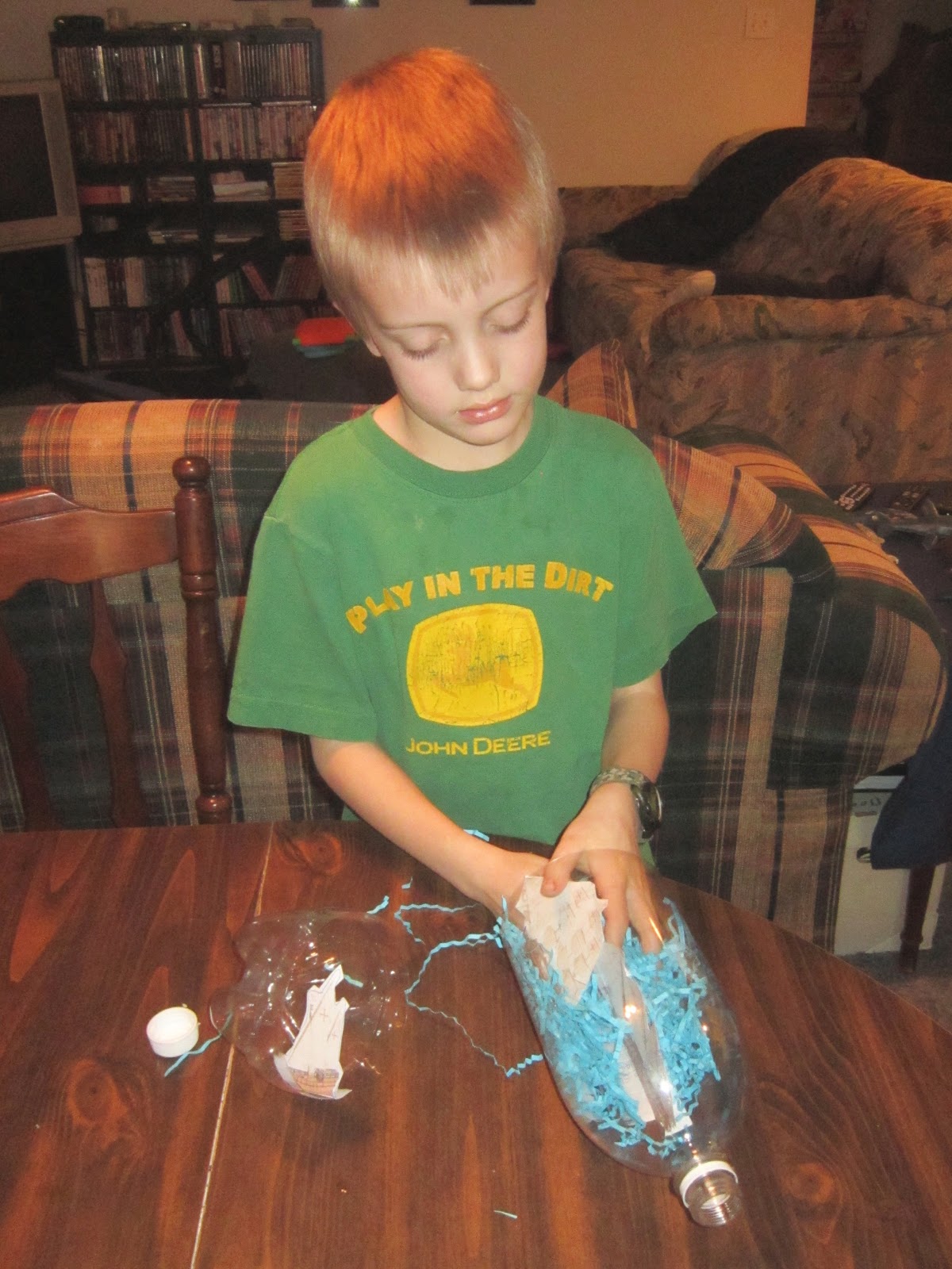
Ships In A Bottle
We used a 2 liter soda bottle for this activity. We printed out the Ships In A Bottle on cardstock. Next we cut the end of the bottle off and taped the ships in where we wanted them. Then we put int blue shredded paper for the water.
I taped the bottle back together with clear packing tape so you could still see the ships through the bottle.


Eating Like Sailors
For snack food, have something that the sailors might have eaten on Columbus’s voyage such as; dried fruit, cheese, honey, almonds, etc… Eat snacks on the floor using their hands to eat with (like the sailors)
Make hardtack (sea biscuits):
6 parts flour
1 part water
Knead dough until thoroughly mixed. Roll out on a floured surface until about 1/8 inch thick (or there abouts). Cut into squares about 3 by 3 inches.
Pierce the hard tack 12 times with the tip of a knife, making sure hole goes all the way through the dough.
Bake at 325 for at least an hour, turning over the hard tack once. Check to see that it is cooked through completely. Take out & let cool overnight to get that real hard & dry feeling.
Columbus and Crew Viewpoints
Help your students understand the different viewpoints of Columbus and his crew. Teacher reads Columbus and students read the crew. Encourage them to read their parts with feelings. For this activity we used “Columbus and Crew Rap” on page 16 of Hands on History Christopher Columbus by Mary Tucker.
Sailors Journal
Columbus recorded the date and how many miles he traveled in his logbook. The crew on his ship were hungry, scared, and ready to go home. Pretend you are a member of Columbus’s crew. Write a journal entry describing what you have seen and how you are feeling.
